
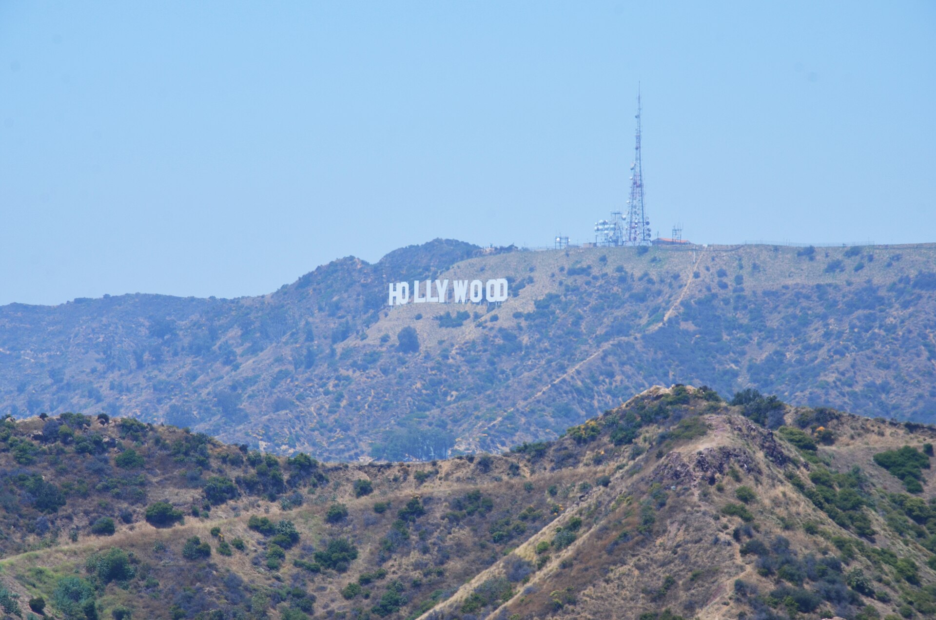
Los Santos, the city in Grand Theft Auto V, is Rockstar’s version of Los Angeles, and much of it is drawn street by street from the real thing. The Vinewood Sign, the Galileo Observatory, Del Perro Pier and the Maze Bank Tower all stand in real Los Angeles under other names. This guide pairs 25 GTA 5 locations with the real places they are based on, says what each one is like in person, and suggests a route for seeing the best of them in a day. Opening hours change, so check before you go.
GTA 5 locations in real life: the full list
Every pairing below is the real-world influence named for that location on the GTA Wiki. Places the game only loosely echoes are left out.
| GTA 5 (Los Santos) | Real Los Angeles | Area |
|---|---|---|
| Vinewood Sign | Hollywood Sign | Hollywood Hills |
| Galileo Observatory | Griffith Observatory | Griffith Park |
| Vinewood Hills | Hollywood Hills | Hollywood |
| Vinewood Boulevard | Hollywood Boulevard | Hollywood |
| Oriental Theater | TCL Chinese Theatre | Hollywood |
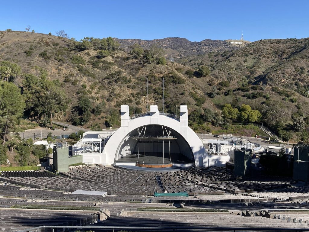
| Vinewood Bowl | Hollywood Bowl | Hollywood |
| Tequi-la-la | Whisky a Go Go | Sunset Strip, West Hollywood |
| Rockford Hills | Beverly Hills (with parts of Century City) | Westside |
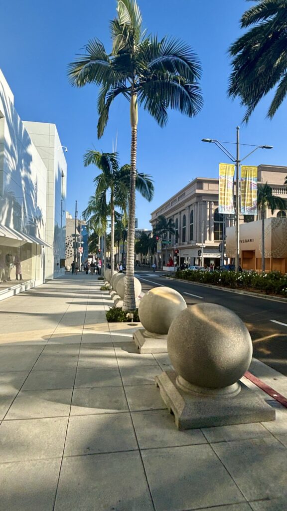
| Portola Drive | Rodeo Drive | Beverly Hills |
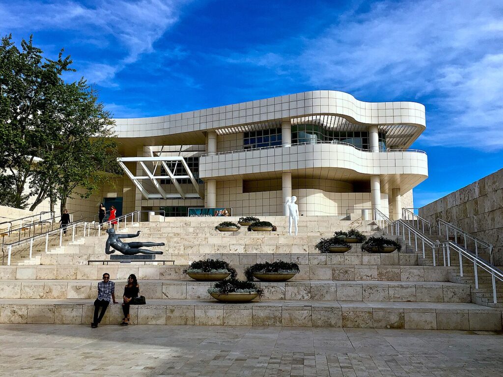
| Kortz Center | Getty Center | Brentwood |
| Del Perro | Santa Monica | Westside coast |
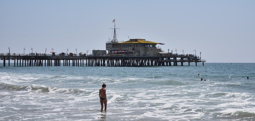
| Del Perro Pier | Santa Monica Pier | Santa Monica |
| Vespucci Beach | Venice Beach | Venice |
| Pacific Bluffs | Pacific Palisades | Westside coast |
| Chumash | Malibu (its eastern end) | Malibu |
| Great Ocean Highway | Pacific Coast Highway (State Route 1) | The coast |
| Pillbox Hill | Bunker Hill | Downtown LA |
| Maze Bank Tower | U.S. Bank Tower | Downtown LA |
| Legion Square | Pershing Square | Downtown LA |
| Little Seoul | Koreatown | Mid-City |
| Mirror Park | Echo Park and Silver Lake | Eastside |
| Los Santos River | Los Angeles River | Runs through the city |
| Los Santos International Airport | LAX | Westchester |
| Elysian Island | Terminal Island | Port of Los Angeles |
| Alamo Sea | Salton Sea | Colorado Desert, about three hours from LA |
Vinewood: Hollywood in real life
Vinewood is where the game and the real city line up most closely, and it is where most visitors start.
Vinewood Sign: the Hollywood Sign
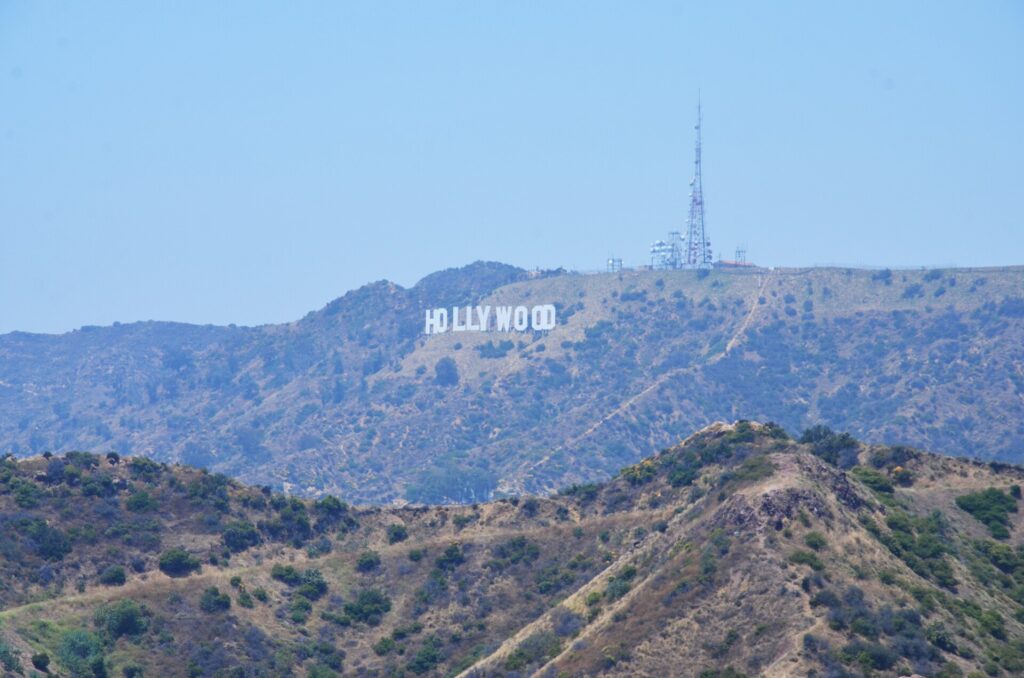
The Vinewood Sign sits on the hills above the city exactly as the Hollywood Sign does on Mount Lee. The game even borrows its history: the real sign went up in 1923 reading “Hollywoodland” and lost its last four letters in 1949. You can’t walk up to the letters, which are fenced off and watched, but there are good free viewpoints. Griffith Observatory, Lake Hollywood Park and the terrace at Ovation Hollywood all frame it well. Our post on facts about the Hollywood Sign covers the best spots.
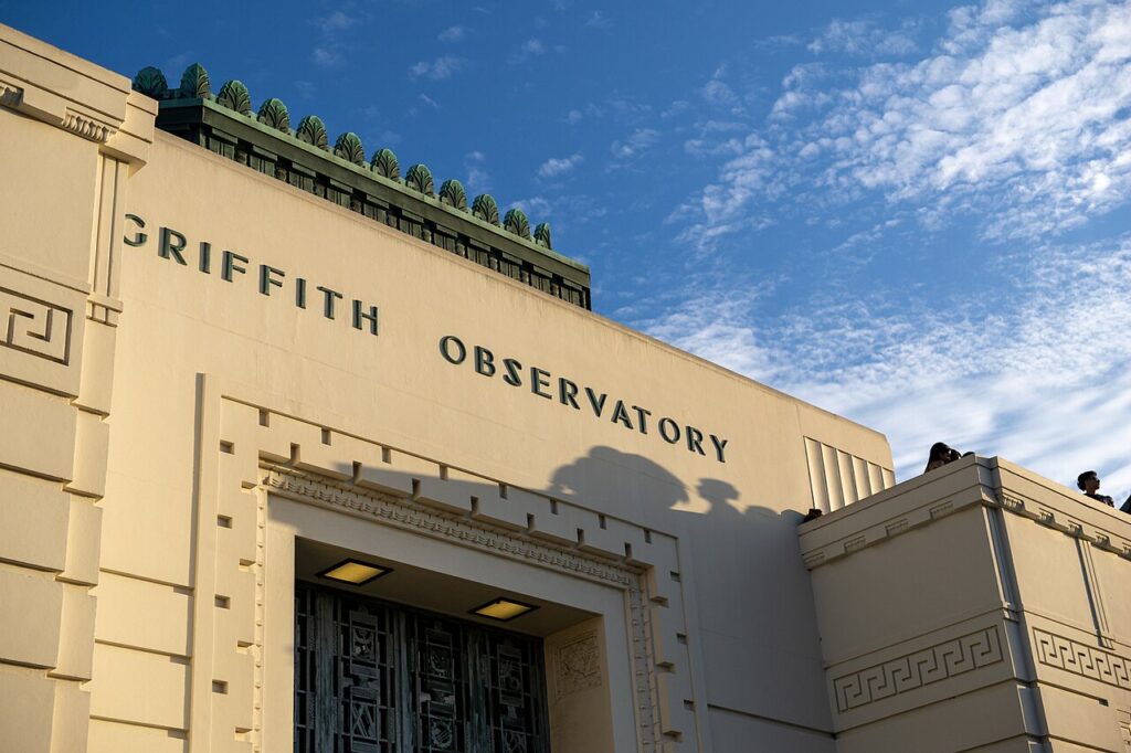
Galileo Observatory: Griffith Observatory
The Galileo Observatory is one of the most faithful copies in the game, down to the Astronomers Monument on the front lawn, which in real life also includes a figure of Galileo. Griffith Observatory opened in 1935 on the south slope of Mount Hollywood. Entry to the building and grounds is free, though parking on the hill is paid and fills up at sunset. It is closed on Mondays. From the terraces you get the same sweep the game gives you: downtown, the Westside, the ocean on a clear day and the Hollywood Sign behind.
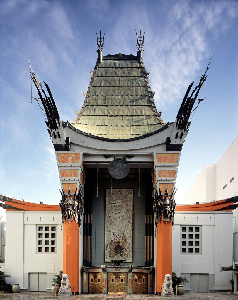
Vinewood Boulevard, the Oriental Theater and the Vinewood Bowl
Vinewood Boulevard is Hollywood Boulevard, complete with its own Walk of Fame. The real one has more than 2,700 terrazzo stars set into the sidewalk. The Oriental Theater is the TCL Chinese Theatre, opened in 1927 as Grauman’s Chinese and still famous for the handprints and footprints in its forecourt. Up the road, the Vinewood Bowl is the Hollywood Bowl. Like the real amphitheater, the in-game bowl is named for the hillside it is carved into. The real Bowl has hosted summer concerts since 1922. For more on the area, see our guide to things to do in Hollywood.
Tequi-la-la: the Whisky a Go Go
Tequi-la-la, the rock club in the game, is modeled on the Whisky a Go Go on the Sunset Strip in West Hollywood. The Whisky opened in 1964 and helped launch The Doors and many other bands. It still puts on live shows most nights, so you can stand outside the real version of a GTA 5 hangout or buy a ticket and go in.
Rockford Hills: Beverly Hills and the Getty
Rockford Hills, where Michael De Santa lives, is based on Beverly Hills: large Spanish-style mansions, manicured lawns and a luxury shopping street, with some office towers borrowed from neighboring Century City. That shopping street, Portola Drive, is Rodeo Drive, and the game’s Little Portola stands in for Two Rodeo, the short cobblestone lane off it. Real Beverly Hills is easy to explore on foot around Rodeo Drive. The grand homes are private, so they are best seen from the street, and from a car, as most visitors do. Greystone Mansion, a public park with gardens, is the exception; our Greystone Mansion guide has the details.
Kortz Center: the Getty Center
The hilltop Kortz Center is the Getty Center in Brentwood. The real campus was designed by Richard Meier, opened in 1997, and is built largely of pale travertine. A tram carries visitors up from the parking garage at the foot of the hill. Admission is free; parking is paid. The gardens and terraces look across the Westside to the ocean.
Del Perro and Vespucci Beach: Santa Monica and Venice
Del Perro is Santa Monica. Its name, Spanish for “of the dog”, is likely a nod to the area’s old nickname, Dogtown. Del Perro Pier is the Santa Monica Pier, and the game copies its buildings one by one, from the carousel building to the harbor office. Its Pleasure Pier amusement park is the real Pacific Park, with its Ferris wheel and roller coaster. Even the S-shaped road climbing the cliff from the coast highway to downtown Del Perro is real: it is the California Incline.
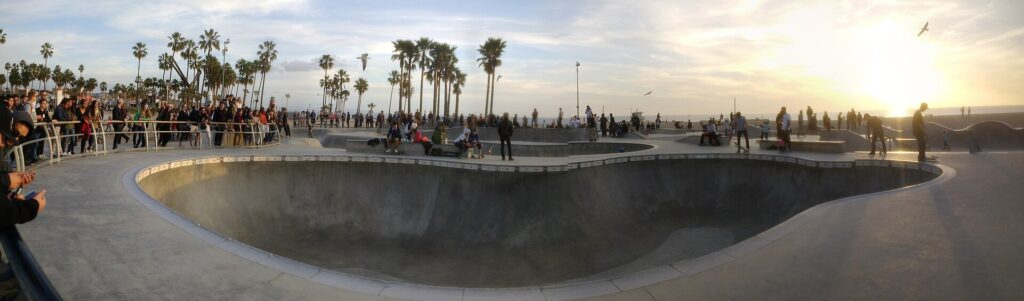
A short walk or bike ride south, Vespucci Beach is Venice Beach. The real boardwalk has the same mix of street performers, souvenir stalls, the Muscle Beach outdoor gym and a skatepark right on the sand. Rent a bike in Santa Monica and ride the beach path between the two for the most GTA-like way to see them.
Pacific Bluffs, Chumash and the Great Ocean Highway
North of Del Perro, the Great Ocean Highway follows the real Pacific Coast Highway, State Route 1. Pacific Bluffs is based on Pacific Palisades, and the beach homes along the highway are modeled on those on Palisades Beach Road. Further on, the beach town of Chumash resembles eastern Malibu. In real life, the January 2025 Palisades Fire destroyed much of Pacific Palisades and damaged parts of eastern Malibu, and rebuilding continues. The drive along the coast is open, but please treat the burned neighborhoods as the residential areas they are.
Pillbox Hill and Legion Square: Downtown LA
The towers of Pillbox Hill are Bunker Hill, the business district of Downtown LA. The tallest of them in the game, the Maze Bank Tower, is based on the U.S. Bank Tower. At 1,018 feet it was the tallest building in Los Angeles from 1989 until the Wilshire Grand Center topped it in 2017. Bunker Hill is also home to the short Angels Flight funicular and to museums such as The Broad, covered in our Los Angeles museum guide.
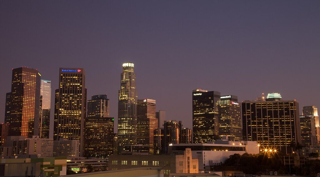
Legion Square, the plaza at the heart of the game’s downtown, is an almost exact copy of Pershing Square, the oldest public park in Los Angeles. In GTA Online it even gets a Christmas tree each winter.
Little Seoul and Mirror Park
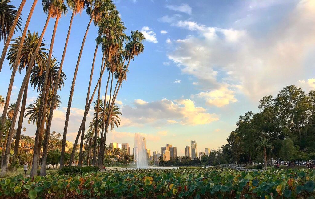
Little Seoul is Koreatown, one of the densest neighborhoods in the city, known for Korean barbecue, late-night restaurants and historic buildings along Wilshire Boulevard and 6th Street. Mirror Park, with its lake and young creative crowd, draws on Echo Park and Silver Lake. Echo Park Lake, with its fountain, paddle boats and summer lotus beds, is the easiest piece to visit.
The river, the airport and the port
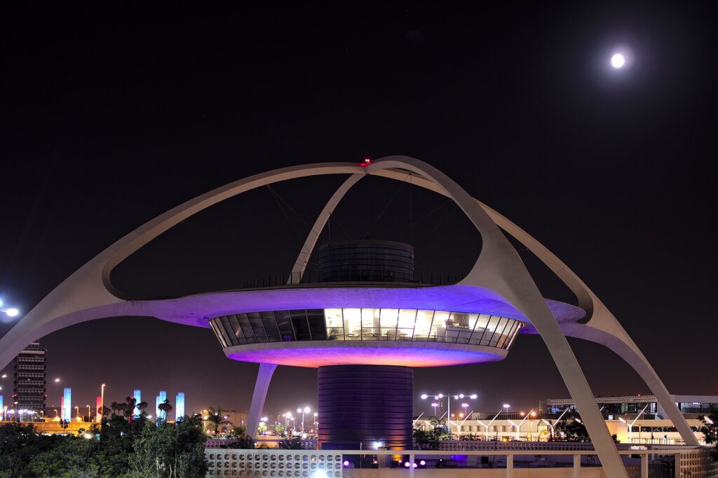
The Los Santos River is the Los Angeles River. Like the real one, it starts as a natural stream in the hills before running through a wide concrete channel, the setting for chase scenes in films such as Grease and Terminator 2. Los Santos International Airport is LAX, with a near carbon copy of its road layout, control tower and the 1961 Theme Building in the middle of the terminal loop. Elysian Island, the game’s docks and industrial island, is based on Terminal Island at the Port of Los Angeles.
Out in Blaine County, the Alamo Sea is the Salton Sea in the desert southeast of Los Angeles. Both are the result of an accident: the real lake formed when the Colorado River broke through irrigation canals in 1905. It is roughly a three-hour drive from LA, so it is a separate day trip.
How to see the GTA 5 locations in one day
Los Angeles is spread out, so group the places by area and start early. A route that covers the most recognizable landmarks:
- Morning, Hollywood: a Hollywood Sign viewpoint, then Griffith Observatory, then Hollywood Boulevard and the Chinese Theatre.
- Midday, Sunset Strip and Beverly Hills: the Whisky a Go Go, then Rodeo Drive and the mansion streets of Beverly Hills.
- Afternoon, the Getty or downtown: pick one. The Getty Center is on the way to the coast; Downtown LA (Bunker Hill and Pershing Square) needs its own detour.
- Sunset, the coast: the California Incline, Santa Monica Pier and the boardwalk to Venice Beach.
Driving yourself means traffic and paid parking at almost every stop. If you’d rather leave that to someone else, our private GTA 5 tour of Los Angeles picks you up in Hollywood, Beverly Hills or Downtown LA and builds the route around the places you know from the game, in a luxury SUV or a classic 1970 Cadillac convertible. Short on time and mainly after the Hollywood landmarks? The Private Hollywood Tour covers the Vinewood side in three hours.
GTA 5 locations in real life: FAQ
Is Los Santos based on Los Angeles?
Yes. Los Santos is Rockstar’s version of Los Angeles, and the surrounding state of San Andreas draws on Southern California, including the coast, the Hollywood Hills and the desert around the Salton Sea. Many landmarks are close copies of real buildings, while the street grid is compressed so the city fits in a game.
What is the Vinewood Sign in real life?
The Hollywood Sign on Mount Lee in the Hollywood Hills. Like the Vinewood Sign, it once had a longer name: it read “Hollywoodland” until 1949.
What is the Maze Bank Tower in real life?
The U.S. Bank Tower on Bunker Hill in Downtown Los Angeles, 1,018 feet tall and the city’s tallest building until 2017.
Can you visit the GTA 5 locations?
Almost all of them. Griffith Observatory, the Getty Center, the Walk of Fame, Santa Monica Pier, Venice Beach and Pershing Square are free and open to the public. The Hollywood Sign can only be seen from viewpoints, and the homes of Beverly Hills and the Hollywood Hills are private, so they are seen from the street.