

For most people starting in Southern California, the fastest route to Las Vegas is simple: Interstate 15, all the way. What changes from trip to trip is how long that route actually takes, because on I-15 the clock is set by traffic far more than by distance. This guide covers the main routes to Las Vegas from Los Angeles, the scenic alternatives through the Mojave, the drive from Sacramento and Northern California, the stops worth pulling over for, and the other ways to get there: flights, buses and the high-speed train that is still under construction. Road conditions, attraction hours and schedules change, so check before you go.
The Fastest Route to Las Vegas from LA: I-15
From Downtown Los Angeles to the Las Vegas Strip is roughly 265 to 270 miles, almost all of it on I-15. With clear roads that is about four to four and a half hours of driving. On a busy weekend, five to six hours is more realistic, and a bad Sunday afternoon heading back to LA can take longer still. No other road route comes close on time, so if speed is the goal, the only real question is when you leave.
Turn-by-turn, the short version
- Get to I-15 North. From Downtown LA or Hollywood, take I-10 East or I-210 East; from the Westside or LAX, I-10 East is usually the quicker start. Both meet I-15 in the Inland Empire around Ontario and Rancho Cucamonga.
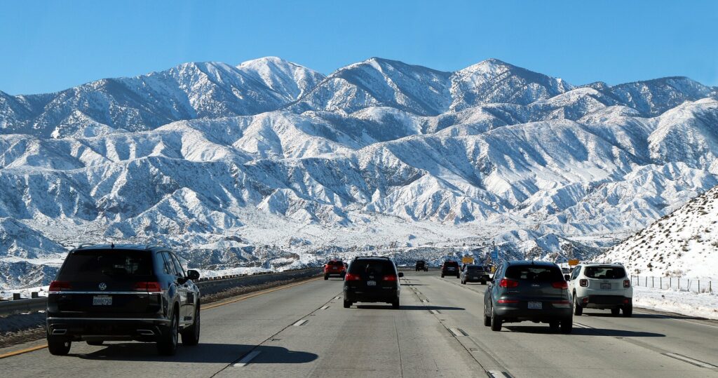
- Climb the Cajon Pass. North of San Bernardino, I-15 climbs between the San Gabriel and San Bernardino Mountains to Cajon Summit, a little over 4,000 feet up. This grade is the first big bottleneck of the trip and can see snow and wind closures in winter.
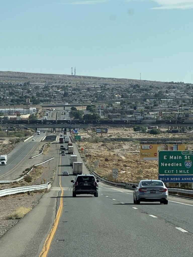
- Cross the high desert. Past Victorville and Hesperia, you reach Barstow, the natural halfway point for fuel and food.
- Run the Mojave. From Barstow the freeway heads northeast through open desert past Yermo and Baker, then climbs over Mountain Pass.
- Cross into Nevada at Primm. The state line casinos at Primm are about 40 miles from the Strip. Stay on I-15 north, or exit to Las Vegas Boulevard if you want the Welcome sign at the south end of the Strip.
How Long the Drive Takes, and When to Leave
The I-15 corridor carries a huge share of weekend traffic between Southern California and Las Vegas, and it moves in tides. The busiest windows are well known:
- Friday afternoon and evening, northbound. The Cajon Pass and the stretch through Victorville back up as LA heads out for the weekend.
- Sunday late morning through evening, southbound. This is the classic jam. Traffic tends to stack up leaving Las Vegas, at the state line around Primm, and on the long climb toward Mountain Pass and Baker, then again coming down the Cajon Pass into the Inland Empire.
- Holiday weekends and big Las Vegas events. Long weekends, major fights, concerts and conventions can turn a four-hour drive into a seven- or eight-hour one.
The fastest way to Las Vegas by car is therefore about timing. Midweek trips are easiest. For a weekend, leave LA before dawn on Friday or after the evening rush, and come home Sunday morning, late Sunday night or on Monday. Check live traffic before you set off and again in Barstow, where you still have choices about when to push on.
Other Routes to Las Vegas from Southern California
The alternative routes to Las Vegas are slower, but they swap freeway for some of the most striking desert scenery in California. Treat them as a day of sightseeing rather than a shortcut.
Kelbaker Road through Mojave National Preserve
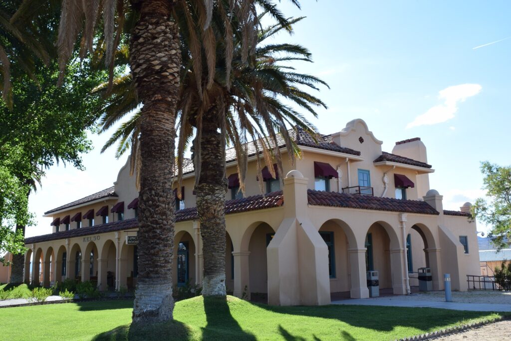
The best-known scenic detour leaves I-15 at Baker and follows paved Kelbaker Road south into Mojave National Preserve, past the Kelso Dunes turnoff, to Kelso Depot, a restored Union Pacific railroad depot that serves as the preserve’s main visitor center. As of the National Park Service’s September 2026 update, Kelbaker Road is open but drivers are warned about potholes and washed-out shoulders, and delays of up to an hour are possible at the Kelso railroad crossing. The depot’s indoor area is closed for rehabilitation of its heating and cooling system; the outdoor areas, restrooms, parking and water filling are open. The Kelso Dunes access road is rough washboard, and the park service advises high-clearance vehicles. You can continue south to I-40, or simply loop back to I-15, but either way plan on adding several hours. Check the preserve’s Alerts & Conditions page before you go, and carry water.
Route 66 and the I-40 option
The other alternative is to leave I-15 at Barstow and head east on I-40 toward Needles and Kingman, Arizona, then turn north on US-93 past Hoover Dam into Las Vegas. That is around 420 miles from Los Angeles, so it only makes sense as a road trip in its own right. Stretches of the old Route 66 alignment, signed in California as National Trails Highway, run alongside both freeways. Between Victorville and Barstow, the old road passes through Oro Grande and Elmer’s Bottle Tree Ranch, which makes a pleasant hour off I-15. East of Barstow, old Route 66 is remote, with long gaps between services; check San Bernardino County road status before planning around it.
Driving from Sacramento and Northern California
From Sacramento, the drive to Las Vegas is roughly 560 to 575 miles, or about nine to ten hours of driving before stops. There are two main ways to go:
- South through the Central Valley, then I-15 via Barstow. Take I-5 south (or CA-99 through the valley towns), pick up CA-58 near Bakersfield, cross the Tehachapi Mountains to Barstow, and join I-15 north for the last 150 or so miles. This is usually the quickest option, at around 560 miles, and it has the most fuel, food and lodging along the way. The trade-off is that you join the same I-15 traffic as Los Angeles drivers, so the Friday and Sunday advice above still applies.
- East over the Sierra, then US-95 via Reno and Tonopah. Take I-80 to Reno, then head south through western Nevada on US-95 through Hawthorne, Tonopah and Beatty into Las Vegas. The distance is similar, about 575 miles, and it usually takes a little longer, but it avoids Southern California traffic entirely and crosses big, empty Great Basin country. Services are far apart: fill up in Hawthorne and Tonopah, and expect long stretches without cell coverage. In winter, check conditions over Donner Summit on I-80 before choosing this way.
Many Northern California travelers split the trip with a night in Bakersfield or Barstow on the southern route, or in Reno or Tonopah on the eastern one. For a short weekend, it is also worth comparing flights from Sacramento to Las Vegas.
Worthwhile Stops Along I-15
Even on the fastest route, a few stops make the drive far better. These are listed in order heading toward Las Vegas.
Elmer’s Bottle Tree Ranch (Oro Grande)
On old Route 66 between Victorville and Barstow, this open-air folk art site is a forest of metal “trees” hung with hundreds of colored glass bottles and roadside salvage. The late Elmer Long built it, and his family still keeps it open; admission is free. It requires leaving I-15 at Victorville and rejoining at Barstow, so allow extra time.
Calico Ghost Town (Yermo)
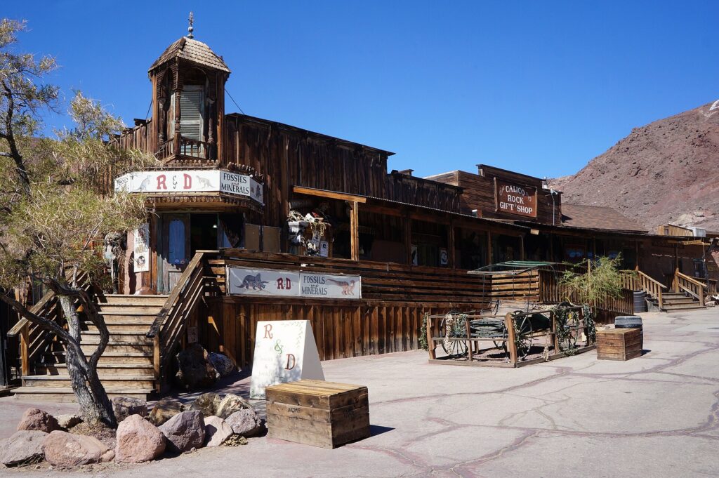
A few miles off I-15 just past Barstow, Calico Ghost Town Regional Park preserves a silver-mining town founded in 1881 and abandoned in the mid-1890s when silver lost its value. Walter Knott, of Knott’s Berry Farm, bought it in the 1950s and restored the old buildings; today San Bernardino County runs it as a regional park with shops, a mine tour and a short railroad. The county lists daily hours of 9 a.m. to 5 p.m. and adult admission of $8, with separate fees for some attractions.
Peggy Sue’s 50’s Diner (Yermo)
Near the Calico exit, Peggy Sue’s is a roadside diner built in 1954 from railroad ties and mortar and reopened by its current owners in 1987. It is a classic burgers-and-shakes stop, with a small five-and-dime and pizza parlor on the same property. It is the most popular meal break on the drive, so expect a wait on weekends.
Zzyzx Road
The exit sign everyone photographs is real. Zzyzx Road leads a few miles south from I-15, just west of Baker, to a former health resort that is now California State University’s Desert Studies Center inside Mojave National Preserve. Visitors can use the parking area and the short, accessible Lake Tuendae trail during daylight hours; the rest of the grounds are closed to the public. The park service notes a gravel section with potholes and ruts, so take it slowly.
The World’s Tallest Thermometer (Baker)
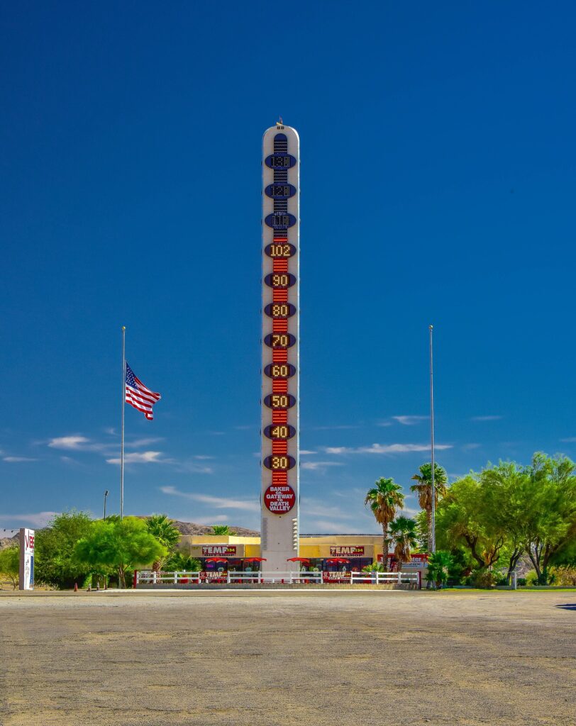
Baker’s 134-foot thermometer stands for the 134°F reading recorded in nearby Death Valley in 1913. It went up in the early 1990s, went dark for a while, and was relit after a 2014 renovation. In 2026 the owning family put the landmark up for sale, so its future operation is worth checking, but it is visible from the freeway either way. Baker is also the last real fuel and food stop before Nevada.
Seven Magic Mountains
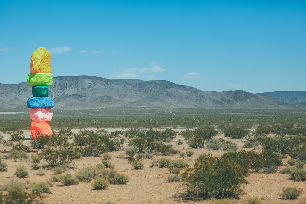
Just south of Las Vegas, off Las Vegas Boulevard near Jean Dry Lake, Swiss artist Ugo Rondinone’s seven towers of stacked, day-glo painted boulders have been one of the most photographed sights on the drive since 2016. The installation sits on Bureau of Land Management land under a lease that runs to December 2026, and as of November 2026 the Nevada Museum of Art had not announced what happens after that. If it is on your list for 2027, check the museum’s site first. There is no shade and no water at the site.
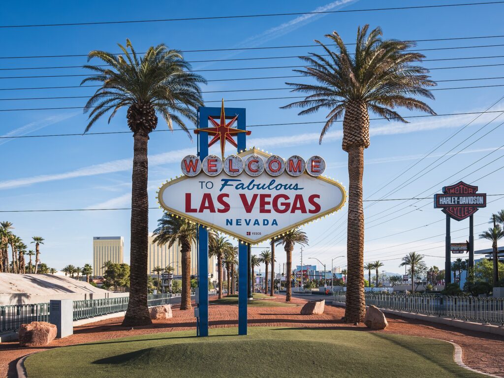
The “Welcome to Fabulous Las Vegas” sign
The 1959 sign stands in the median of Las Vegas Boulevard at the south end of the Strip and is listed on the National Register of Historic Places. There is a small parking lot in the median, and it is a good first photo before checking in.
Desert Driving Tips
- Respect the heat. Summer temperatures in the Mojave regularly pass 100°F, and the long climbs toward Mountain Pass are hard on engines and tires. Check coolant and tire pressure before you leave, and keep the A/C load in mind on the grades.
- Carry water. Keep at least a gallon per person in the car, more if you plan to leave the freeway for the preserve or old Route 66.
- Plan fuel stops. Barstow and Baker are the main service towns between the Inland Empire and Primm. Fill up in one of them rather than gambling on the gaps.
- Check live conditions. Caltrans QuickMap (quickmap.dot.ca.gov) shows California closures, chain controls, incidents and live traffic. On the Nevada side, NDOT’s 511 service (nvroads.com, or dial 511) does the same.
- Watch the winter weather. The Cajon Pass and Mountain Pass both see occasional snow, ice and high wind, which can slow or close I-15 for hours.
- Take breaks. The desert stretch is long and straight, which makes fatigue the real hazard, especially on the late-night drive home.
The Fastest Way to Las Vegas Without Driving
Flying: LAX, Burbank or Ontario to Harry Reid (LAS)
Las Vegas is served by Harry Reid International Airport (LAS), a few minutes from the Strip. From the LA area, nonstop flights leave LAX, Hollywood Burbank (BUR), Ontario (ONT) and Long Beach (LGB), and the flight itself is a little over an hour. Southwest alone runs multiple daily nonstops from Burbank and Ontario. Once you add the trip to the airport, security and the ride from LAS, flying is not always much faster door to door than a clear-road drive, but it wins easily on a peak Friday or Sunday. The smaller airports are often the quicker choice if you live nearby.
Buses: Greyhound and FlixBus
Greyhound runs several daily buses from Union Station in Downtown LA to Las Vegas, and FlixBus serves the route as well, with stops on and near the Strip. Expect roughly five to six hours, depending on traffic and the number of stops. It is the cheapest option, but rarely the fastest.
Brightline West high-speed rail
There is currently no passenger train between Los Angeles and Las Vegas; Amtrak’s Desert Wind, the last one, ended in 1997. Brightline West is building a roughly 218-mile high-speed line, mostly in the I-15 median, from Rancho Cucamonga (with a Metrolink connection to Los Angeles) via stations in the Victor Valley and Hesperia to a terminal south of the Las Vegas Strip, with a planned trip time of a little over two hours. Construction officially began in April 2024. In January 2026 Brightline said it was targeting completion in late 2029, after dropping its earlier goal of opening before the 2028 Olympics, and through 2026 the company was still working to close part of its financing. Treat late 2029 as a target, not a timetable.
Letting Someone Else Drive
Driving yourself gives you freedom, but the return trip after a late night in Las Vegas is where most people wish they were not behind the wheel. A private driver turns the I-15 crossing into part of the trip: you can stop at the Welcome sign or wherever else catches your eye, and leave the Sunday traffic to someone else. Our LA to Las Vegas tour is a two-day private trip in a luxury SUV with pickup in Los Angeles, a drive across the Mojave, time on the Strip and Fremont Street, and the return ride the next day.
Fastest Route to Las Vegas: FAQ
What is the fastest route from Los Angeles to Las Vegas?
Interstate 15. From central LA, take I-10 or I-210 east to I-15 North, then follow it over the Cajon Pass and through Barstow, Baker and Primm to Las Vegas. It is roughly 265 to 270 miles.
How long is the drive from LA to Las Vegas?
About four to four and a half hours with no traffic. Five to six hours is more realistic on weekends, and Sunday afternoon returns to LA can take longer.
How far is Sacramento from Las Vegas by car?
Roughly 560 miles via I-5 or CA-99, CA-58 and I-15 through Barstow, or about 575 miles via Reno and US-95 through Tonopah. Plan on nine to ten hours of driving before stops.
Is there a train from LA to Las Vegas?
Not yet. Brightline West’s high-speed line from Rancho Cucamonga to Las Vegas is under construction, with the company targeting completion in late 2029. Until then, the choices are driving, flying or the bus.