
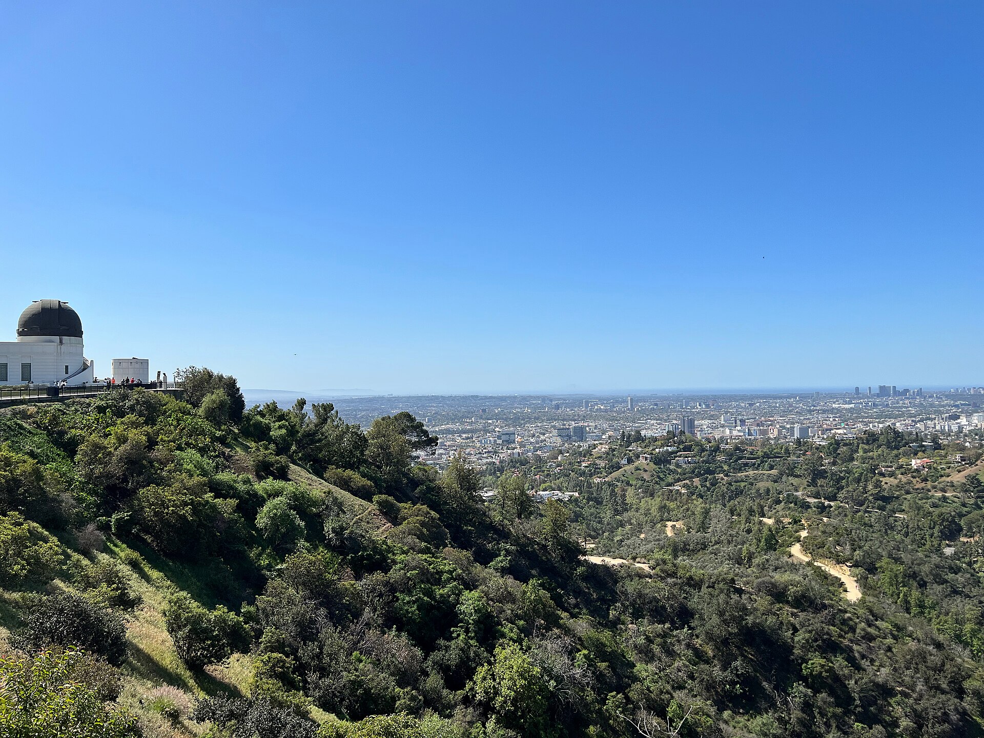
Few big cities put this much hiking this close to the hotels: canyon strolls in Griffith Park, ocean-view ridges in the Santa Monica Mountains, Malibu bluffs, San Gabriel waterfalls and a 10,000-foot summit. This guide covers 15 of the best hikes in Los Angeles that are open as of November 2026, grouped by area, with distance, elevation gain, difficulty and a parking tip for each.
One thing has changed since older guides were written. The January 2025 Palisades and Eaton fires burned through some of the city’s most popular trails, and several are still closed nearly two years later. Every trail below was checked against the land manager’s own notices. Trail status, parking fees and hours change, especially after storms and during fire season, so check before you go.
Best Hikes in Los Angeles at a Glance
Distances are round trip unless noted; elevation figures vary a little between sources.
| Trail | Area | Distance | Elevation gain | Difficulty |
|---|---|---|---|---|
| Fern Dell & West Observatory Trail | Griffith Park | 2.1 mi | 540 ft | Easy–moderate |
| Mount Hollywood from the Observatory | Griffith Park | 1.4–2.7 mi | about 500 ft | Moderate |
| Brush Canyon to Mount Lee | Griffith Park | 6.4 mi | 1,050 ft | Moderate |
| Bronson Caves | Griffith Park | 0.7 mi | 50 ft | Easy |
| Runyon Canyon loop | Hollywood Hills | 2.7–3.3 mi | 700–800 ft | Moderate |
| Los Liones to Parker Mesa Overlook | Pacific Palisades | 7.8 mi | 1,300 ft | Moderate–strenuous |
| Rivas Canyon Trail | Pacific Palisades | 2.1 mi one way | 480 ft | Moderate |
| Inspiration Point (Will Rogers) | Pacific Palisades | about 2 mi | Moderate climb | Moderate |
| Solstice Canyon | Malibu | 2.6 mi | 300 ft | Easy |
| Rock Pool & Century Lake | Malibu Creek State Park | about 3 mi | 125 ft | Easy |
| Point Dume | Malibu | about 1 mi | 100 ft | Easy |
| Baldwin Hills Scenic Overlook stairs | Culver City | 282 steps | Short and steep | Moderate |
| Sturtevant Falls | San Gabriel Mountains | 3.3 mi | about 700 ft | Moderate |
| Mount Baldy via the Ski Hut | San Gabriel Mountains | about 9 mi | 3,900 ft | Strenuous |
| Seascape Trail, Point Vicente | Palos Verdes | 1.5 mi | 40 ft | Easy |
Hollywood Hills and Griffith Park
Griffith Park is central, free to enter and laced with fire roads leading to the Griffith Observatory and close-up views of the Hollywood Sign. The park reopened after the January 2025 Sunset Fire, and the Hollywood Sign Trust notes that authorized trails are open from sunrise to sunset every day.
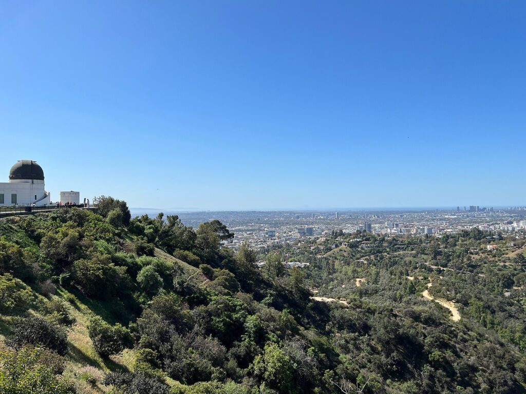
1. Fern Dell and the West Observatory Trail
2.1 miles, 540 ft gain, easy to moderate. Start in Fern Dell, a shaded, stream-side glen at the park’s southwest corner, then climb through Western Canyon to the Observatory terrace. Highlight: walking up to the building instead of circling for parking. Parking: the lot closest to the Observatory is paid and fills fast; starting from Fern Dell avoids it. The Observatory itself is free and open Tuesday to Sunday (closed Mondays), while its grounds open early each morning.
2. Mount Hollywood via the Charlie Turner Trail
1.4 miles (steep) or about 2.7 miles (scenic), around 500 ft gain, moderate. From the Observatory, the Charlie Turner Trail climbs a wide fire road to the summit of Mount Hollywood; the shorter route is steeper. Highlight: 360-degree city views, including a clear look across the canyon at the Hollywood Sign on Mount Lee. Parking: Observatory lots or the roads below; arrive early on weekends.
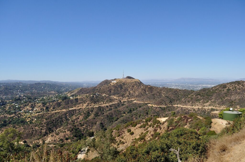
3. Brush Canyon to Mount Lee and the Hollywood Sign
6.4 miles, 1,050 ft gain, moderate. This out-and-back starts at the top of Canyon Drive and follows fire roads up to the summit of Mount Lee, directly behind the Hollywood Sign. Highlight: you look down over the backs of the letters toward Hollywood and the basin. The sign itself is fenced, watched by cameras and off limits, so the summit road is as close as you can legally get. Parking: street parking near the trailhead at the top of Canyon Drive; arrive early on weekends. For the story behind the letters, see our surprising facts about the Hollywood Sign.
4. Bronson Caves
0.7 miles, 50 ft gain, easy. A short walk from the same Canyon Drive area leads to a tunnel left over from an early 1900s quarry. It became the Batcave entrance in the 1960s Batman television series and has appeared in many other films and shows. Parking: the same Canyon Drive area as Brush Canyon.
5. Runyon Canyon
About 2.7 to 3.3 miles as a loop, 700–800 ft gain, moderate. Runyon is LA’s see-and-be-seen hike, a steep loop above Hollywood with views to downtown and the Hollywood Sign. The park’s main entrance is at 2000 N. Fuller Ave., and it is open sunrise to sunset. The West Trail closed after the January 2025 Sunset Fire; WEHO Times reported it reopened in February 2026, though some sections remain fenced and the city’s park page still lists it as closed. Follow the signs at the gate. Parking: neighborhood street parking only; read the posted restrictions carefully.
If you would rather see the Hollywood Sign without the climb, a private Hollywood tour by car is the low-effort way to take in the sign and the hills.
Westside and the Santa Monica Mountains
The Palisades Fire hit this area hardest, and recovery is still under way. Under a California State Parks order effective June 12, 2026, most of Topanga State Park’s trails and fire roads are open again, with specific exceptions listed further down. Dogs are not allowed on Topanga State Park trails or fire roads.
6. Los Liones Trail to Parker Mesa Overlook
7.8 miles, about 1,300 ft gain, moderate to strenuous. The 1.3-mile Los Liones Trail climbs a canyon off Sunset Boulevard to a ridge junction (550 ft of gain; a good turnaround for a shorter outing), then continues up the East Topanga Fire Road to Parker Mesa Overlook. Volunteers began restoring the trail in January 2026, and it is not among the closures in State Parks’ June 2026 order, but no formal reopening notice names it, so check the Topanga State Park page before you go. Highlight: a bird’s-eye view over Santa Monica Bay. Trailhead: Los Liones Drive, just off Sunset Boulevard.
7. Rivas Canyon Trail, Temescal Gateway Park
2.1 miles one way, 480 ft gain, moderate. Temescal Gateway Park reopened on July 17, 2026, about 18 months after the fire. The rebuilt Rivas Trail climbs to two overlooks and continues to Will Rogers State Historic Park, and the reopened Sunset Trail links to the Temescal Ridge Trail and Topanga State Park. Most of the climbing comes in the first half mile. Highlight: seeing a burned canyon come back to life. Parking: the park’s paid lot; the Mountains Recreation and Conservation Authority sells permits online.
8. Inspiration Point, Will Rogers State Historic Park
About 2 miles, moderate. Will Rogers State Historic Park reopened in November 2025 after the fire destroyed the ranch house. The Inspiration Loop climbs to a viewpoint over the coast and the Westside. Part of it is still affected by repairs: the western half of the loop trail and road has been closed since January 29, 2026, so plan to go up and back on the open side. Parking: $12 per vehicle, 8 a.m. to sunset, and spaces are limited. Dogs are allowed on the Inspiration Loop.
Malibu Hikes
Malibu’s trails come with the bonus of a drive along Pacific Coast Highway. For what to do afterward, see our guide to things to do in Malibu.
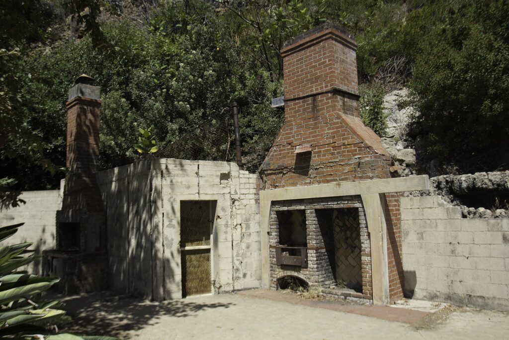
9. Solstice Canyon
2.6 miles, 300 ft gain, easy. A National Park Service trail that follows Solstice Creek up the canyon to the stone ruins of the Roberts Ranch house (known as Tropical Terrace) and a small waterfall just beyond. The first half mile is paved. For more of a workout, the Rising Sun Trail is a harder climb on the canyon’s slopes. Highlight: ruins, shade and a waterfall on one easy walk. Parking: a small lot at Corral Canyon Road and Solstice Canyon Road, a quarter mile up from PCH, that fills quickly on weekends. Leashed dogs are welcome.
10. Rock Pool and Century Lake, Malibu Creek State Park
About 3 miles, 125 ft gain, easy. A nearly flat route to the Rock Pool in the Malibu Creek gorge, with an easy add-on to Century Lake. The park was also where the TV series M*A*S*H was filmed, but State Parks reported on October 29, 2026 that the bridge to the M*A*S*H site has been removed, so reaching it now means crossing Malibu Creek at your own risk. Parking: $12 per vehicle for the day (hourly rates also available), 8 a.m. to 10 p.m. Dogs are not allowed on trails.
11. Point Dume
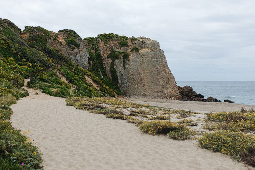
About 1 mile, 100 ft gain, easy. A short trail climbs an old coastal dune to a boardwalk and viewing platform on top of the headland. On clear days you can see Santa Monica Bay, the Malibu coast and Catalina Island, and from December to mid-April it is one of the best spots on the coast to watch gray whales migrate. Parking: the free two-hour lot at the top is very small, and as of late August 2026 the lower lot is unreachable because Westward Beach Road is closed. No dogs or drones.
Central LA: Baldwin Hills Scenic Overlook
12. Baldwin Hills Scenic Overlook Stairs
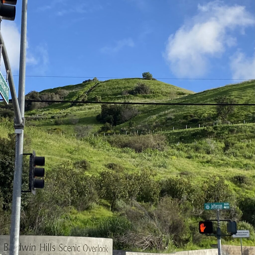
282 steps to a 420-foot summit, moderate. The stairway, built from irregular blocks of recycled concrete, rises straight up the hillside from Jefferson Boulevard in Culver City. A gentler switchback trail crosses the stairs if you want an easier way down. Highlight: a panorama across the LA basin, plus a visitor center with restrooms at the top. Parking: the state park lot at 6300 Hetzler Road costs $2 an hour or $6 a day; the park is open 8 a.m. to sunset.
San Gabriel Mountains
The Angeles National Forest rises right behind Pasadena. The Eaton Fire closure area (Echo Mountain, Sam Merrill, Mount Lowe and the lower Mount Wilson Toll Road) stays closed through December 31, 2027, but trails east of it are open. Parking at most forest trailheads requires an Adventure Pass ($5 a day or $30 a year) or an America the Beautiful pass.
13. Sturtevant Falls
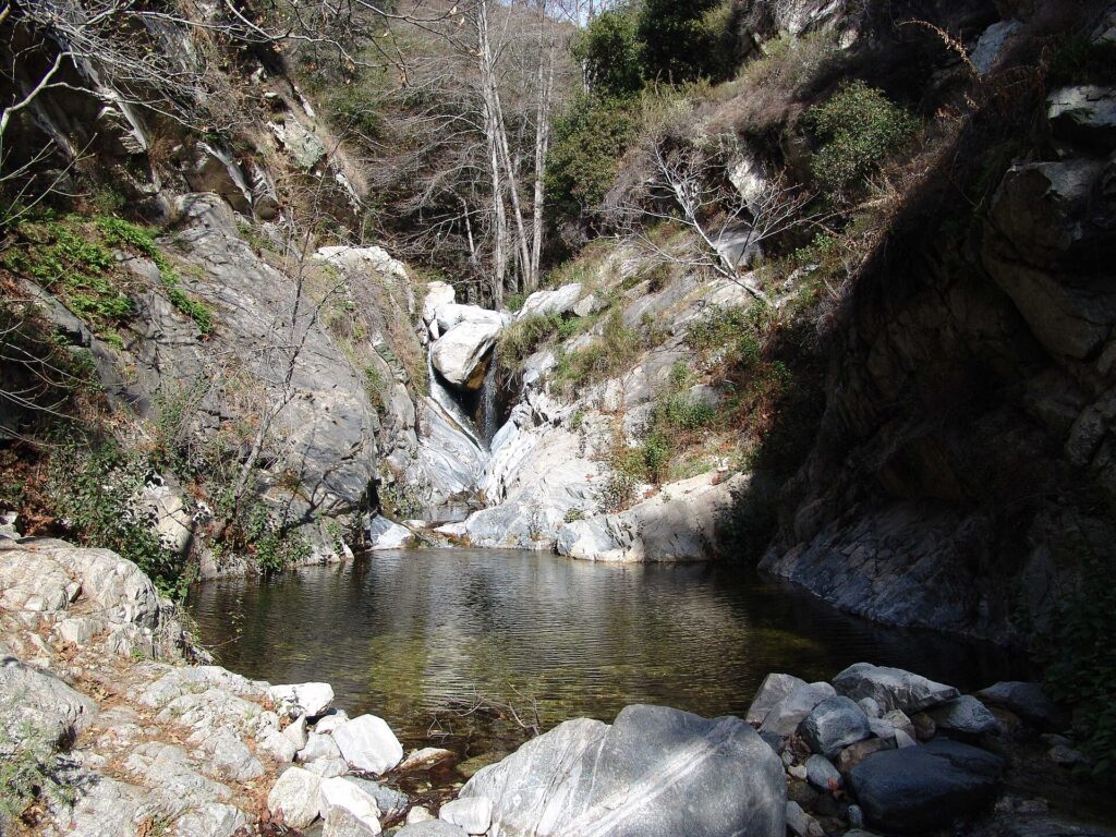
3.3 miles, about 700 ft gain, moderate. From Chantry Flat above Arcadia, the trail drops into Big Santa Anita Canyon and follows the creek to the falls. It is upside down: the climb comes on the way back. The Forest Service lists the Sturtevant Trail, the Gabrielino Trail and the Winter Creek trails as open. Parking: Chantry Flat lots, Adventure Pass required (sold at Adams’ Pack Station); day use is 6 a.m. to 8 p.m., and the access road can close for safety at short notice.
14. Mount Baldy via the Ski Hut Trail
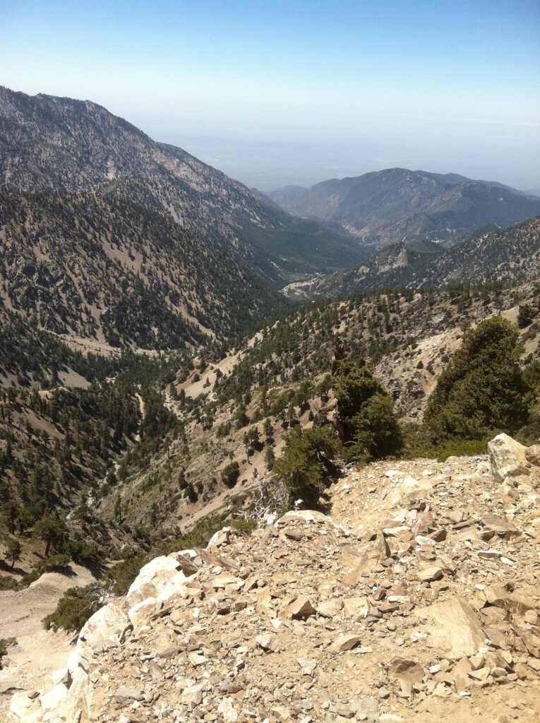
About 9 miles round trip, 3,900 ft gain, strenuous. Mount San Antonio, called Mount Baldy, is the highest point in the San Gabriels at 10,064 feet. The Ski Hut route from Manker Flats climbs past the Sierra Club ski hut and up the Baldy Bowl; many hikers return over the Devil’s Backbone. Using the ski lift shortens it to about 6.6 miles and 2,350 feet. Highlight: the view from LA’s rooftop. This is a serious mountain: from late fall to spring the upper slopes are often icy, and the Forest Service closed the Baldy trails from February 27 to March 20, 2026. Go in summer or early fall unless you have winter gear and experience.
Palos Verdes Peninsula
15. Seascape Trail at Point Vicente
1.5 miles, 40 ft gain, easy. A level path along sage-covered bluffs about 150 feet above the water, with the Point Vicente Lighthouse at the south end and a steep spur down to the tide pools. Highlight: big Pacific views for almost no effort. Parking: street parking at the trail’s residential access points off Palos Verdes Drive. The Palos Verdes Nature Preserve closes after rain, sometimes for 48 hours or more, so check the City of Rancho Palos Verdes trail alerts in winter.
Trails Still Closed After the 2025 Fires
Several trails from older “best hikes” lists are still off limits as of November 2026:
- Temescal Canyon Trail to the waterfall: closed until further notice because of fire damage, even though the rest of Temescal Gateway Park reopened in July 2026.
- Topanga State Park exceptions: Rogers Road Trail (the Backbone Trail segment from Will Rogers), Bent Arrow, Josepho Spur and Rustic Canyon trails, plus the Lower Topanga day-use area and its trails.
- Eaton Canyon: the trail and waterfall in Altadena are closed through December 31, 2027, according to LA County Parks, as are the Altadena Crest Trail and the Forest Service trails to Echo Mountain and Mount Lowe.
- Portuguese Bend Reserve, Palos Verdes: many trails are closed because of the active landslide, along with the beach access trails at Abalone Cove.
We could not confirm the current status of Escondido Falls in Malibu for this update, so it is left off the list. Check the Mountains Recreation and Conservation Authority before planning a visit.
Hiking Safety in Los Angeles
- Heat and water: most LA trails have little shade. Start early, carry more water than you think you need, and turn back if you run low.
- Red flag days: since March 2026, California State Parks, the National Park Service and the two Santa Monica Mountains conservancy agencies follow a shared protocol that closes trails, backcountry areas and NPS parking lots on red flag warning days. Closures are usually announced the day before, and not every closed trail is gated.
- Fire danger: the Angeles National Forest has been at “very high” fire danger since July 2026. Never smoke on trails, and leave stoves at home when restrictions are in effect.
- Rattlesnakes: they are common in warm weather. Stay on the trail, watch where you put your hands and feet, and give any snake plenty of room.
- After rain: burned slopes shed mud and rocks, and creek crossings can rise quickly. Many agencies close trails after storms.
- Daylight: most city and state park trails close at sunset.
Trail Etiquette
Stay on marked trails, especially in burn areas where plants are recovering. Uphill hikers have the right of way, and everyone yields to horses. Dog rules vary: dogs are welcome on leash at Solstice Canyon and on the Inspiration Loop, but not on Topanga or Malibu Creek trails or at Point Dume. Pack out all trash and keep music to headphones.
More Outdoor Activities in Los Angeles
Hiking is only one way to spend a day outside in LA:
- Beaches: from Malibu’s coves to the South Bay piers, our guide to Los Angeles beaches covers where to swim, surf and walk.
- Bike the coast: the paved Marvin Braude Bike Trail, known as the Strand, runs about 22 miles from Will Rogers State Beach to Torrance Beach, past Santa Monica, Venice and the Manhattan, Hermosa and Redondo piers.
- City parks: for picnics and easy walks, see our tour of Los Angeles parks from MacArthur to Balboa.
- Viewpoints: for views without the climb, see the best viewpoints in Los Angeles.
A morning on the trail also leaves the afternoon free. Some visitors pair a Griffith Park hike with an unhurried drive around the city in a 1970 Cadillac DeVille convertible on our classic car tour.
Best Hikes in Los Angeles: FAQ
Is Eaton Canyon open?
No. LA County Parks says the Eaton Canyon trail and waterfall remain closed through December 31, 2027 because of damage from the January 2025 Eaton Fire. Sturtevant Falls above Arcadia is the closest open waterfall hike.
Can you hike to the Hollywood Sign?
You can hike to the top of Mount Lee behind it via the Brush Canyon Trail (6.4 miles round trip), but the letters themselves are fenced, watched by cameras and off limits. Mount Hollywood from the Griffith Observatory gives a closer-than-street view for less effort.
What is the easiest hike in Los Angeles with a view?
Point Dume in Malibu (about 1 mile) and the Seascape Trail at Point Vicente (1.5 miles, nearly flat) give ocean views for very little effort. In the city, Fern Dell to the Griffith Observatory is short and rewards you with a classic view of the basin.
Are LA trails closed on red flag days?
In the Santa Monica Mountains, yes. Under a protocol adopted in March 2026, State Parks, the National Park Service and the local conservancy agencies close trails and backcountry areas on red flag warning days, including Topanga, Malibu Creek, Will Rogers, Solstice Canyon and Temescal. Check park websites the evening before.